
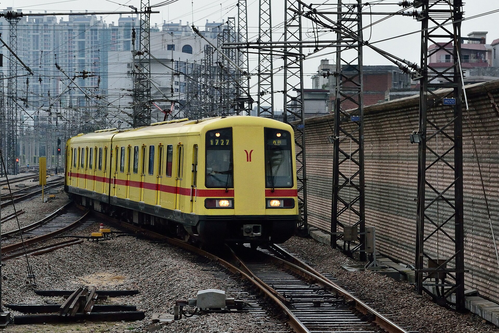
Metro Line 3 links Baiyun Airport's Airport North station with the city, changing at Jiahewanggang for Line 2 into the older districts
Checked October 2026GUIDES / TRANSPORT
Getting Around Guangzhou: Metro First, and Respect the Last 500 Metres
The network itself is fast, bilingual and forgiving. What actually decides your day is which terminal you land at, which station name is printed on your ticket, and which exit you climb out of — here is the system, leg by leg.
City Guangzhou12 min read9 facts labeledChecked 2026-10-30
01 · IN BRIEF
The journey is won at the ends
The high-speed train sighs into Guangzhou South a little before ten at night, and the platform crowd performs the first sorting of the trip: half flows toward the metro, half toward the taxi ranks, everyone moving like they have done this a hundred times. A first-time visitor trailing a suitcase can be forgiven for following the nearest stream. But this station is a city district unto itself, marooned in the southern suburbs — the ride into the old town from here is longer than some intercity hops, and the friend who messaged 'just meet at Guangzhou station' may be standing in a different terminal across town entirely.
That is the whole lesson of moving around this city, compressed into one arrival. The machinery is superb — a vast metro with English on every sign, trains that swallow rush hours, taxis and ride-hailing on every corner. What goes wrong is never the machinery. It goes wrong at the seams: the wrong terminal at the airport, the wrong same-named station on a rail ticket, the wrong exit surfacing you on the far side of an eight-lane road in 34-degree humidity. Learn to plan the ends of journeys and Guangzhou becomes one of the easiest big cities in China to cross.
This guide works through the system in the order you will meet it: the airport's split personality first, then the four railway stations that share one name between them, then the metro as the default middle of every trip, and finally the walking and weather layer that decides whether the last five hundred metres feel like a stroll or a sentence.
02 · SEE IT
Anatomy of a Guangzhou journey
- Leg 1 — Arrival is not arrival: passport control, baggage and the terminal's own internal geography all count before any wheel turns
- Leg 2 — The wait: metro headways are short, taxi queues and ride-hailing pickups are the variable minutes nobody budgets for
- Leg 3 — The ride: the one leg the app measures honestly — which is why headline journey times always look better than the truth
- Leg 4 — The interchange: some Guangzhou stations hide a serious indoor hike between lines; treat it as distance, not as a dot on the map
- Leg 5 — The exit: each station fans out into lettered exits feeding different streets, malls and riverbanks — the right letter is the whole game
- Leg 6 — The final walk: heat, rain, luggage and old-town lanes turn 400 metres into the leg you will actually remember
- Station card — Guangzhou South: the principal high-speed hub, far southwest of the centre; superb rail links, a real transfer still to come
- Station card — Guangzhou East: the Tianhe-side terminal, handiest for the modern east and some Hong Kong-bound services
- Station card — Guangzhou Baiyun: the newer northern station, serving a growing set of conventional and high-speed routes
- Station card — Guangzhou station: the old central terminal in Yuexiu, still busy, still the one many people wrongly assume you mean
- Mode card — River ferries and water buses: the slow, scenic layer. Useless for a deadline, perfect for seeing the waterfront the way the city used to
- Mode card — City buses: the densest network of all and the hardest to use cold; a tool for day three, once your payment apps and map confidence are working
03 · TRY IT YOURSELF
Do it like a local
Your ticks stay on this page only. No account or personal data is sent.
04 · THE PROOF
The facts that shape the plan
The airport's T2 is a metro story (Airport North on Line 3), while T3 is anchored by the Baiyun Airport East intercity station plus road and shuttle links — the two terminals are planned separately
Checked October 2026Municipal updates in 2026 reported T1 closing for renovation with its remaining domestic airlines shifting to T3, so older advice mentioning T1 and Airport South station is out of date
Checked May 2026Intercity rail and the city metro at the airport are separate systems with separate tickets and planning; one does not ride through onto the other
Checked October 2026The city's name appears on four separate stations — South, East, Baiyun and the original central station — each printed differently on tickets and served by different lines
Checked October 2026Most long-distance high-speed routes run through Guangzhou South, and it sits well outside the historic centre, so the hotel transfer afterwards is a journey in itself
Checked October 2026One Pazhou hotel's own published directions put the airport at 46 km and roughly 45 minutes by road, and Guangzhou South at 24 km and roughly 30 minutes — for that address, in normal traffic
Checked October 2026Metro signage across the network is bilingual, and rides are paid by transport QR code or station-bought tickets
Checked October 2026Pearl River ferry and water-bus services still run as public transport, offering a slow cross-river and along-river layer under the metro's speed
Checked October 202605 · STEP BY STEP
Run the system, step by step
- Step 1 — Name your exact gateway before anything else
Every Guangzhou transport decision hangs off two strings of text: the terminal on your flight record and the station name on your rail ticket. T2 sends you to a metro platform; T3 sends you toward an intercity station or a road transfer. Guangzhou South and Guangzhou station are different worlds. Read both strings out loud, type them in full, and only then open a route planner — most transport misery in this city is a naming error made in the first sixty seconds.
- Step 2 — Build the journey in legs, and price each one separately
Break the trip into arrival formalities, waiting, riding, interchanging and the final walk, then estimate each leg from a live query for your actual date and hour. Price the pieces the way the city charges them: metro and intercity rail per traveller, a car per vehicle. A shared taxi quote found online describes somebody else's address, traffic and luck — useful as atmosphere, useless as your budget. Your buffer for luggage, children, signs and weather is a deliberate planning choice, and making it is the difference between a transfer and a gamble.
- Step 3 — Set up money and data before you land
Transport here runs on phones: QR codes at the gates, apps for cars, digital tickets at the stations. Sort mobile data and your payment stack while you still have home Wi-Fi, and keep a second payment route in reserve for the day an app wants one more verification than you have signal for. The municipal government's English transport pages give the system overview; the live apps give the day itself.
- Step 4 — Default to metro for the middle distance
For the long cross-city legs — airport to centre, old town to the riverfront, anything touching Pazhou — the metro is the reliable spine: frequent, air-conditioned, immune to road traffic and signed in English throughout. Ride it with one piece of homework done: your exit letter. Stations here are underground small towns, and surfacing at the wrong portal can add a long, hot, road-crossing walk to what looked like a finished journey. Respect big interchanges, too; a handful involve walks long enough to matter with luggage. In summer the metro doubles as your climate strategy: an air-conditioned cross-town ride in the middle of the day is worth more than the minutes it saves.
- Step 5 — Spend cars on the edges, not the trunk
Taxis and Didi earn their money where the metro is weakest: the first kilometre with suitcases, the last kilometre in rain, the late-night return, the hop between two food stops with tired children. Book through the app or take the staffed queue, send the driver the destination written in Chinese, and pin the exact entrance rather than the attraction's name — large venues have multiple gates and the driver will faithfully reach the one you marked. Expect roads to slow badly around rush hour and major exhibitions, and let that, not optimism, set your margins.
- Step 6 — Treat walking as a weather decision
The old districts repay walking better than anywhere else in the city — Enning Road, Yongqing Fang and Shamian are built for the stroll. But summer heat, humidity, sudden downpours and slick paving all tax the pedestrian, so slice outdoor movement into short blocks joined by air-conditioned transport, carry water, and wear shoes that forgive wet stone. Shared bikes serve residents well; as a visitor, only lean on them once your apps and payment already work, and never build a first day around them.
- Step 7 — Give the river one relaxed job
Not every crossing has to be optimised. The ferries and water buses that still ply the Pearl River are public transport at sightseeing pace, and a single unhurried sailing teaches the city's geography — old bank, new bank, the island in between — better than a day of map study. Ride one when the schedule has slack in it, ideally near dusk, and file it as orientation rather than transport. Just never attach one to a flight, a train or any other fixed point in the day.
06 · WHERE THIS BREAKS
Where this breaks
Headline journey times are advertising, not arithmetic
An app that says 45 minutes is measuring the ride, not the journey. Formalities, queues, interchanges and the final walk are all yours to add — and at the airport or Guangzhou South they routinely outweigh the ride itself. Plan with the leg-by-leg method in this guide, not the banner number.
Airport information has a shelf life right now
With T1's renovation closure and airlines migrating to T3 through 2026, terminal arrangements are a moving target. Anything printed — including older pages of this site — can age out within a season. Verify your terminal's current ground-transport setup on the airport's official channels in the week you travel.
Exhibitions bend the road network
Pazhou fair periods and big shopping-district peaks can double road times on the eastern corridors. On those days the metro stops being the default and becomes the only sane option for time-critical trips, including airport runs with a flight attached.
The old town's last mile runs on foot, like it or not
Liwan's lanes predate cars, and some heritage addresses simply cannot be reached door-to-door by vehicle. Expect a final walk from a drop-off point, occasional thresholds and stairs at older sites, and plan luggage accordingly — a taxi gets you close, not necessarily to the door.
A first day is the wrong day for cleverness
Buses, shared bikes and multi-hop local shortcuts all work — for people whose apps, language and payment are already warm. Arrive, ride the metro spine, take cars for the awkward edges, and let the clever options audition on day two or three, when a mistake costs an hour instead of a connection.
07 · KEEP READING
Keep the trip moving
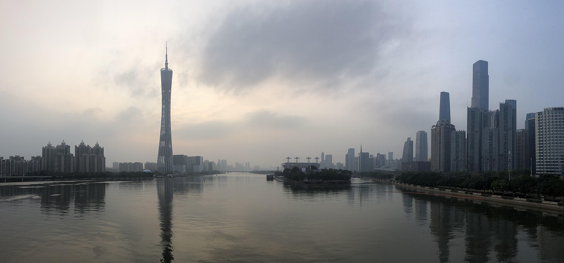 Guangzhou · DoGuangzhou for First-Timers: Teahouses in the West, Towers on the RiverThis is really two cities sharing one name — a merchant old town of arcades and morning tea in the west, and a glowing riverfront of towers in the east. Give each its own day, eat seriously in between, and the place clicks.Verified
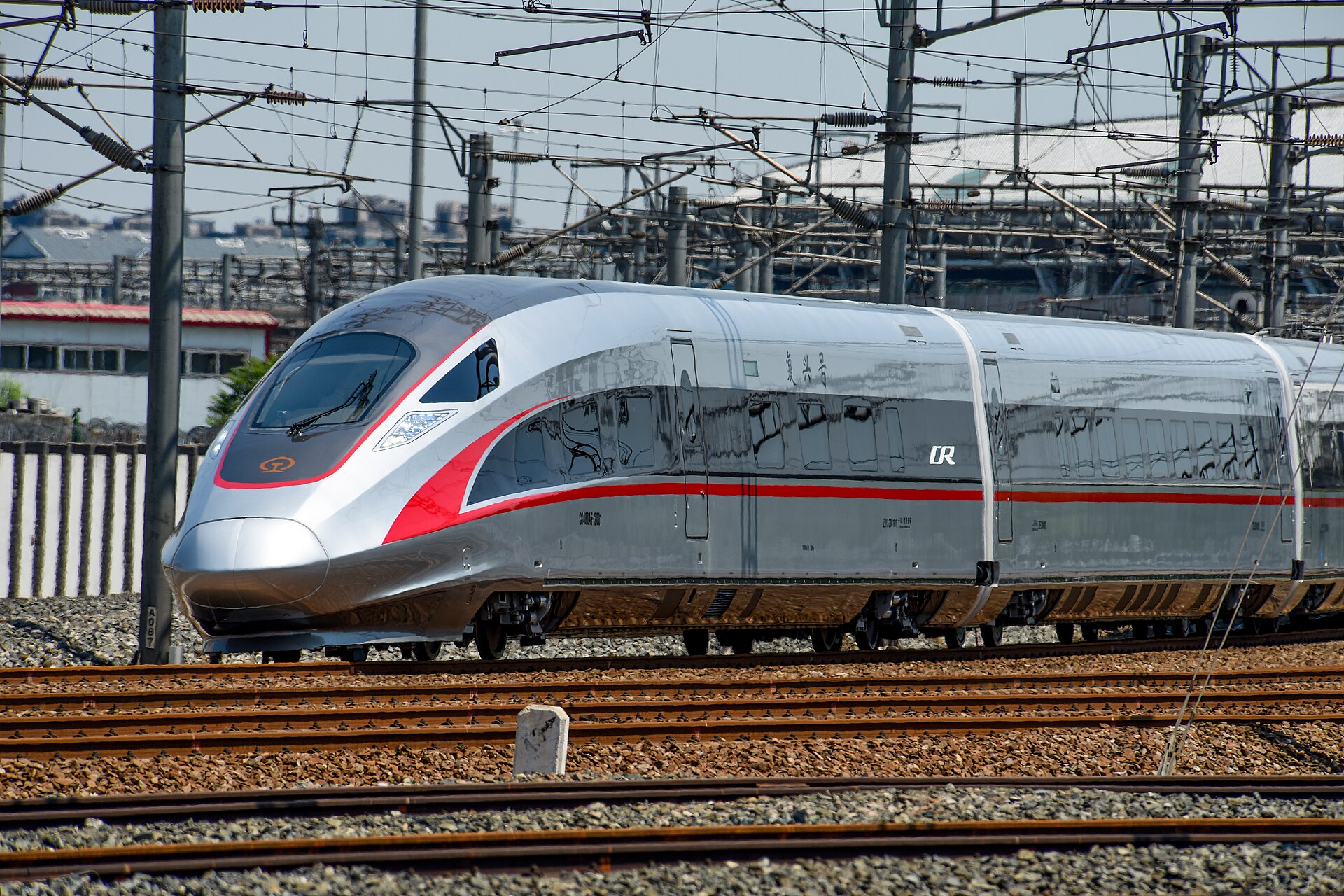 China · PrepareChina Trains: Your Passport Is the TicketNo paper, no ticket window — book on 12306, verify your identity once, and board on the document in your pocket. The system is simpler than the stations are big.Verified
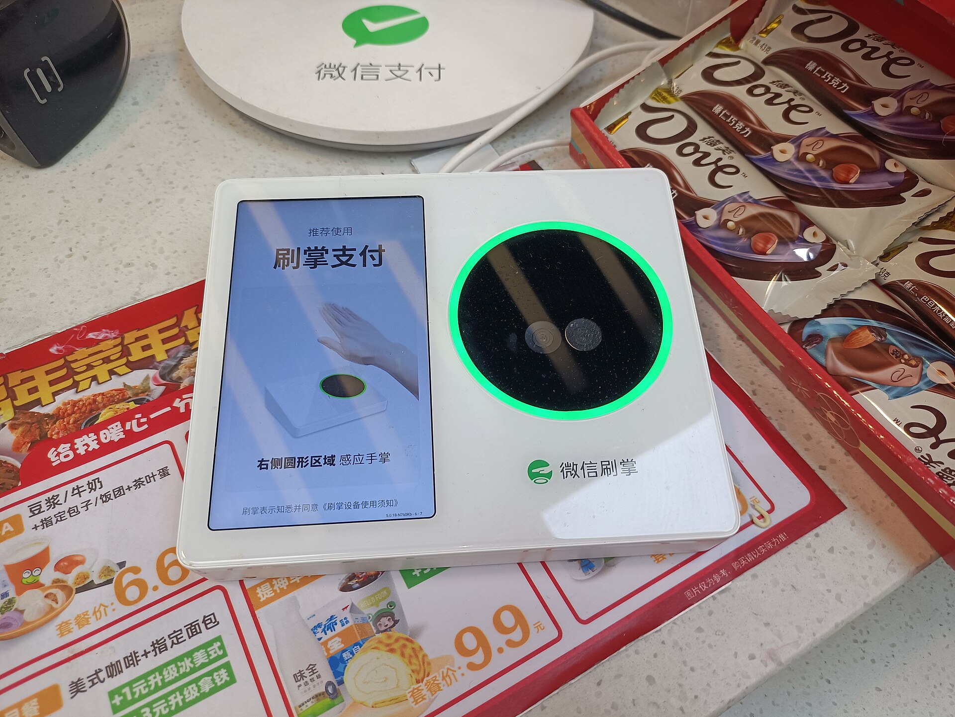 China · PrepareHow to Pay in China (2026): Alipay, WeChat Pay, TenPayGo, Cards and CashSet up one wallet before you fly, add a second as backup, and understand the two numbers that explain most payment confusion.Reference ~
08 · SOURCES
Sources and status
Prices, schedules and booking channels change. Recheck the details that matter before you travel.
- Guangzhou Metro (official site)VerifiedNetwork maps, ticket and payment rules, station exits and service notices
- Guangzhou Baiyun International Airport (official site)VerifiedTerminal ground-transport guidance — the current word on T2/T3 arrangements
- Guangzhou International — the city government's English portalVerifiedMunicipal public-transport orientation and official visitor notices
- 12306 China Railway (English booking portal)VerifiedOfficial rail ticketing; the exact station name on the ticket governs the transfer plan